Developing a custom approach to data and technology
Project: TxDOT
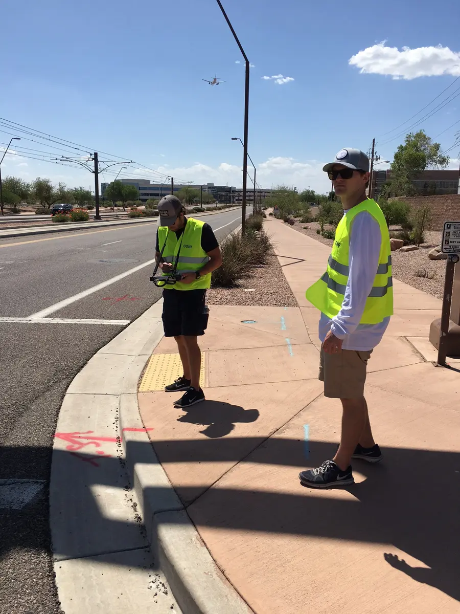
Cole’s multi-disciplined team brought GIS consulting services to the ADA Transition Planning process. The GIS consulting team worked closely with TxDOT to uncover individual data user needs. This allowed us to create a plan and process that captured the right data in the right way, making it usable and effective through all phases of ADA Transition Planning and remediation.
A partner for comprehensive data collection & application
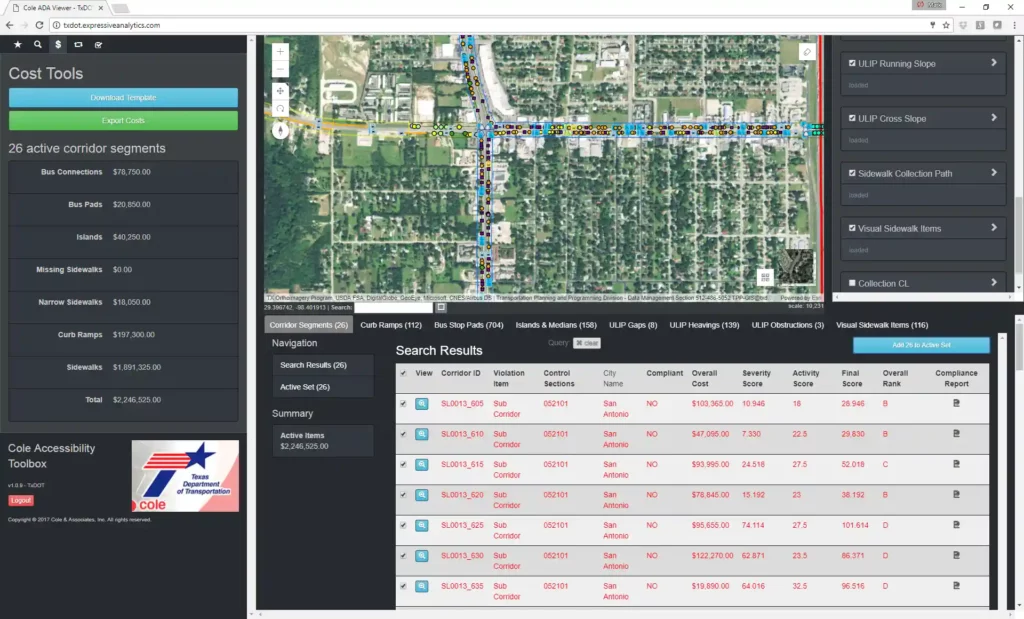
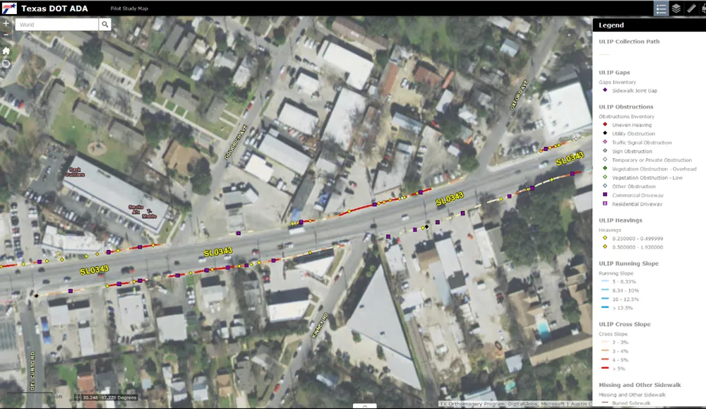
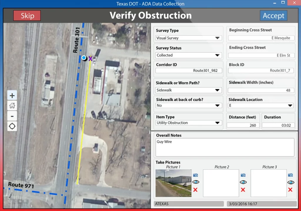
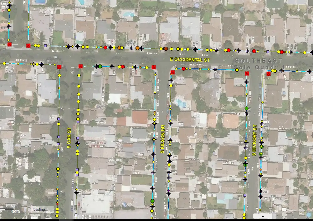
After successfully leading a pilot study data collection for TxDOT, our GIS consulting team wrote collection data specifications and protocols to allow the three primary consultant teams to participate in a statewide data collection effort. The custom technology includes: GIS based analysis tools, cost estimating tools, prioritization algorithms and a web viewer with a remediation tracking tool.
Project Stats
Phases of a multi year plan that includes GIS solutions
0
TxDOT users involved in workshops conducted by Cole to uncover data needs
0
A comprehensive approach to data collection & analysis
Our work with TxDOT began with defining various options for data collection methodology for sidewalks, intersections, access to transit stops and accessible pedestrian signals (APS). We then designed the statewide database, coordinated with TxDOT for data collection, built the data collection tools, processed and analyzed data, summarized and developed the algorithm for the entire prioritization aspect.
Making data usable
The usability of data is determined in the planning process, when an agency determines what to gather and how to gather it. This is the point when gis consulting services are critical and competent, comprehensive guidance can impact the entire span of a multi-year ADA Transition Planning process. Useful data clearly and effectively aids in implementation of planning and remediation tracking. TxDOT is set up for success with all of their data incorporated into their own GIS database and live web app, which ensures that violations come from the database as soon as they are addressed.


