


GIS consulting to
transform decision-making
GIS
GIS experts at Cole integrate many different kinds of data using geographic information to create maps that transform our understanding and ultimately lead to better communications, analysis, and decision-making.

Making GIS data actionable requires it to be integrated and available in your business enterprise solutions. Our expert GIS consulting team will lead your integration process to ensure your data is always accurate and up-to-date.
Our team will recommend, set up, and manage the database that best meets your needs and the goals for your data.
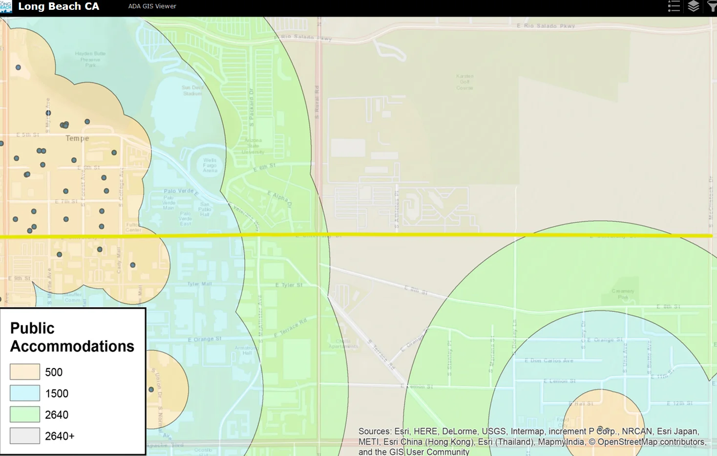
Placing your data in the context of location helps uncover trends and patterns and brings you insights to power better decisions.
Bringing your data to life helps increase accuracy and efficiency on the job site, which can reduce costs and improve performance.
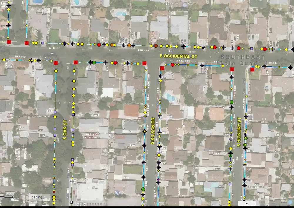
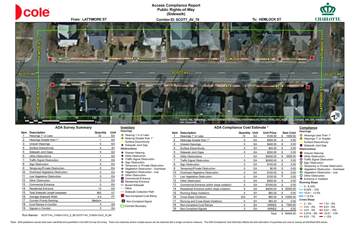
With our extensive experience in municipal GIS public infrastructure data collection, compilation, analysis, and map production, we can create a comprehensive and customized solution for you.
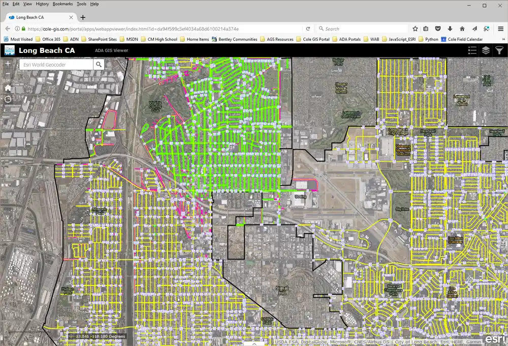
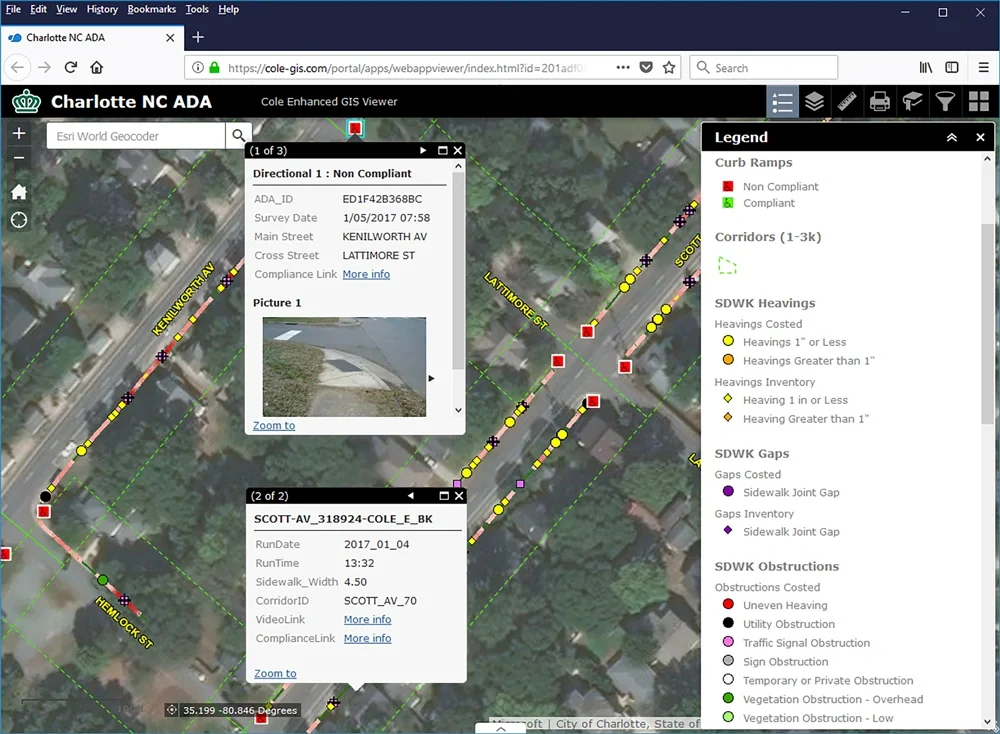
A custom web app allows you to quickly and easily share your geospatial data and processing tools with your entire team, ensuring your data is accessible from anywhere.
Work with us to improve your systems, invest in your team, and leverage GIS technology to propel your company forward.
An ESRI Bronze Partner
Our GIS team has partnered with ESRI, the global market leader in GIS software, location intelligence and mapping, since 2013. This partnership gives us access to a worldwide community of companies and GIS consulting firms that deliver cutting-edge geographic spatial solutions and services based on ESRI technology.
Through access to best practices, emerging technologies, technical expertise, and support, our partnership with ESRI helps ensure that our clients get the industry’s most innovative solutions.

The GIS Team

Will Snyder
GIS Project Manager
Will Snyder
Will has 15 years of GIS experience in design and production roles in a variety of GIS base map and LiDAR projects for federal, state, and local governments, as well as private agencies. Will has extensive GIS processing and editing experience, and demonstrated abilities in GIS process development, documentation and training. Using his accumulated skills, Will supports data processing and provides quality control for GIS data and projects. He also performs reporting of transportation features for ADA compliance and analysis for remediation cost estimates.
Mark Mosby
Vice President of Technology
Mark Mosby
Mark offers extensive experience and expertise as Cole’s GIS/Technology Manager for ADA Self-Evaluation & Transition Planning clients. Overseeing all customization for each client’s specific technology needs, he ensures a seamless transition of data into the client’s technological environment. Mark builds custom tools for interactive data collection in ArcPad mobile tablets and powerful GIS analysis tools in ArcGIS server to prioritize barriers based on usability and condition. Mark has also developed a project portal to facilitate communication and collaboration among constituents, and he manages sophisticated software enhancements which cost estimate and prioritize project data.
Featured Project


